When the topic of me doing the family hike this year came up, my wife Deaun asked me why the hesitation. I love the out doors. Hiking, fishing camping Mt biking ect. I knew Mt Whitney was the highest peak in the lower 48 and all I could envision was the documentaries I had seen on Everest and remembering the mountaineering it took to climb it and most important the altitude. I finally had to had admit to her that I had two concerns to over come. First of all my fear of heights. Second, my concern was altitude sickness. She started to laugh! You the one who rides his motocross bikes at 40 plus MPH on the the track and catapulting himself into the air 20 plus feet and think nothing of it!


Or not to mention the fact one of your favorite places to ski is out at the Book Ends at Snowbird. To get out there it requires a traverse around a cliff where the tips of your skis hang half way over a 300 foot drop off. Ya, right you scared of heights! No! Really I am! Ever since my college room mates took me out repelling and strapped a modified jock strap around my waist and called it a harness. Hooked it to a rope and said jump! Right of the side of a cliff I went! Ya, I am scared of heights!

But my fear of high places and how I deal or not deal with will be address in another instalment of my blog. The intention of this installment is to deal with High Altitude Sickness. Which for the record, I unknowingly experienced this first hand. When I was in my last year of my training, the chairman of the department offered me a deal that I could not turn down. He offered my a trip to the location of my choice for additional training if I finished out my residency as the Chief resident. This required me to do the call rotation for the rest of the year, Which was a nightmare to do. I agreed to do it. Knowing I would be most likely heading back to ski country, I picked a ski meeting in Breckenridge Colorado.
Breckenridge sits at 9,000+ feet above sea level. Omaha, well, not even close. So I arrive in Denver, drove to Breckenridge and checked into my hotel. I arrived late, got a bite to eat and went to bed. My nights sleep was poor and very restless. I awoke the next morning. I now truly understood what the band Y and T meant by the lyrics of their song Ballroom Boogie "I woke up this morning with a trash can head!" No had not been drinking. I my head felt like it was going explode. I took some Motrin and started to feel a little better. I set off for the breakfast put on by the conference. As usual there were announcements. One in particular caught my attention. "If anyone of you is suffering form high altitude sickness please let us know so we can get you evaluated". I thought to my self no way. I could not have high altitude sickness. I am from Utah. I grew up at altitude. I spent my summers in the Unita mountains fishing. Literally running from one lake to the next at altitudes higher than here. I spent my winters skiing at 10,000+ feet off the tram at Snowbird! Altitude sickness, No Way! Not me! I forgot one simple fact. I had spent the last 9 years of my life in the Midwest. Not even close to elevation I was currently at.

Yep, that's right. Altitude sickness. I had it. It was mild but I had it. It slowly resolved and by the last day I was there I was able to ski and enjoy my trip.
Altitude sickness can be very dangerous. Two years ago a physician from LA died from it after hiking Mt Whitney. Two hikers last year had to come off the mountain and be hospitalized according the the official web site because of it. The silver lining for me and my brothers here is the vast majority of people suffering from altitude sickness come from sea level to the trail head and off they go up the mountain. Because we live at 5,000 feet above sea level this gives our bodies a fighting chance.
So what is altitude sickness? What causes it? And how can we prevent it or at least minimize the effects of altitude?
Altitude sickness results from a low concentration of oxygen. As one moves from sea level to higher altitudes the oxygen in the air decreases secondary to the pressure of the surrounding air decreases. There is a old rule of thumb "for every 1,000 feet of elevation gain you loose about 3% of the oxygen in the air" This rule is not totally correct. So at sea level the oxygen concentration is 21%. At 18,000 feet it is 10.5% and at the top of Everest it is about 6%. At the top of Mt Whitney where we are headed, the oxygen concentration is reported to be about 12%.
High altitude sickness usually occurs at altitudes over 4,000 ft, is caused primarily by hypoxia but is also compounded by cold and exposure. It presents as one of three forms: Acute Mountain Sickness (AMS), High Altitude Pulmonary Edema (HAPE) and High Altitude Cerebral Edema (HACE). The symptoms include dyspnea on exertion (short of breath) and at rest, cough, nausea, difficulty sleeping, headache, restless sleep and mental status changes. These symptoms are very similar to the flu. Vomiting can also occur. The symptoms occur secondary to the low oxygen (hypoxia), creating demands on the heart and lungs to work harder to compensate. The increase in the blood pressure of the pulmonary system leads to swelling, if allowed to progress leads to leaking of the capillarys in the pulmonary tissues thus developing into HAPE. The same physiologic effects that occur in the lungs eventually start to effect the brain leading to elevated blood pressure and swelling that result in HACE.
The first description of AMS, written in 32 b.c., attributed to To Kan, a Chinese governmental official, who noted, “A man's face turns pale, his head aches and he begins to vomit” when crossing the Himalayan Kilak Pass. The occurrence of AMS depends primarily on the rate of ascent, the altitude attained and the individual person's susceptibility. AMS affects 15 to 30 percent of Colorado resort skiers, 50 percent of climbers on Mount McKinley, 70 percent of climbers on Mount Rainier, and 25 to 50 percent of climbers who trek to the base of Mount Everest. Bottom line, nearly 25 percent of those who travel above an elevation of 8,500 ft develop manifestations of high-altitude illness. The rate of ascent and time spent at altitude all factor into the development of these issues. It takes at least 1 to 3 days for the symptoms of HAPE or HACE to set in.
The best treatment is to stop your ascent, acclimate and then continue on. If you are not improving or getting worse descend the mountain. It is recommended to descend the mountian1,500 feet for AMS and 2,000 feet for HPPE and HACE. Get oxygen supplementation and seek medical attention.
Prevention of AMS and related diseases is still being investigated. However the amount of exertion and the rate of ascent play big roles in the development of these diseases. It is also strongly recommended to take time to acclimate to the altitude. One recommendation is to do a
staged ascent. This involves traveling to an intermediate altitude and camping for several nights before continuing the ascent to the target altitude. For example, if a person is planning a prolonged trek at 10,000 to 14,000 ft (Mt Whitney), he or she should acclimatize at 6,000 to 8,000 ft two to four days beforehand it is also recommended to Hike high during the day and sleep low at night. All of this is in our plan for what we are going to do on our hike up Mt Whitney.
Simply stated, the best prevention is to do slow ascents and acclimate. Usually in increments of 1,000 to 2,000 feet per day. Again, hike high during the day and sleep low at night.
For us on our trip to Mt Whitney, we already live at about 5,000 ft and we are spending our first night at the Whitney Portal which is above 8,000 ft. This will allow us to acclimate to the altitude. I have also built in to my training regiment elevations at or above 8,000 ft on a regular basis to help acclimate me to altitude during extreme physical activity. Although physical fitness is not proven to eliminate AMS the better shape one is in has been proven to help with work tolerances and better performance physically.
Also in the realm of prevention and treatment are medications. Diamox can can help as well as dexamethasone and procardia. Most important is aggressive hydration and keeping up with nutritional demands of the hike will help prevent AMS. There are some homeopathic remedies but none have prove in scientific trials to really work.
Diamox is a sulfa based diuretic that stimulates the renal system to increases the amount of bicarbonate that passes into the urine. Bicarbonate draws water alongside it from the kidneys into the urine. Which in turn increases urine production (weakly) and increases the acidity of the blood. Given the loss of the bicarbonate, a basic buffer in the blood, Hydrogen ions increase. This increase increased the acidity of the blood which has been made more basic from the increased breathing rate to meet oxygen demands. This in turn increases the efficiency of pulmonary system to supply more oxygen to the system. If you are allergic to sulfa you should not take this drug.
Procardia is a calcium channel blocker. It is unique in the fact that it is one of the few medications that works directly on lowering the blood pressure in the pulmonary arteries. Thus treating the cause of HAPE.
Dexamethasone is a steroid that decreases the inflammatory response within the vascular system thus treating the capillary leak effect of the hypertension and treating the edema within the the tissues of the lungs and brain.
Before you take any of these drugs or involve your self in this extreme environment you should consult your physician to make sure you are fit enough to involve yourself in this type of activity and which drugs you may or may not need.
So there you have AMS in a nut shell. Acclimate. Ascend into thin air slowly. If you start to experience symptoms, stop and acclimate. If symptoms do not improve or worsen descend to a lower altitude. Any sign of HAPE or AHCE seek medical attention ASAP!
Through knowledge I have empowered myself to be better prepared thus allowing me over come one of my concerns. Knowledge is power! I will keep on training and and learning. I truly believe the better understanding one can have of their fears the better it is to cope and most defiantly over come them!
There is so much more and I have resources if you want to learn more. Below I have included the best paper I found on the topic. I just felt that I should cover the basic facts and give a foundation for those heading out in to thin air!


 The trail is an easy traverse up the mountain. At 2.9 miles (8,952 feet, N 40, 33.197'; W 111, 41.725) there is a second bridge that if you take the right turn and cross it, it will take you the May Bird area. Stay to the left and follow the trail. At times you are following the stream. Just walk on the rocks and stay off the mossy bog to the right. It is wet and muddy.


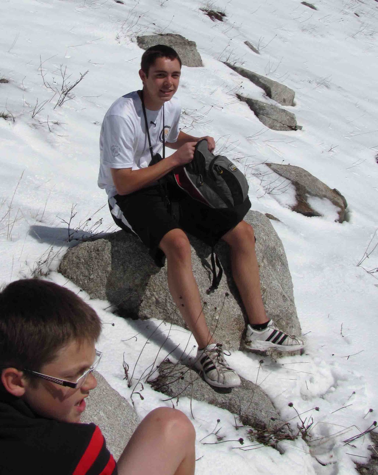


 As we headed back we continued to talk about the time in the future we will on e day come and ski this mountain! As we continued to hike we took photo's and continued to take in the surroundings.


